 vesseltracker.com
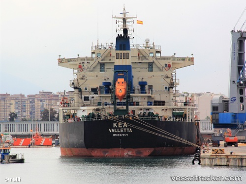
Vessel Kea IMO: 9473171, MMSI: 248150000 Bulk Carrier
UTC, 37.47458, 126.61078, course: 338, speed: 0
UTC, 37.47459, 126.61084, course: 338, speed: 0
2026-01-28 01:59:27 UTC, 37.47462, 126.61082, course: 337, speed: 0
Live AIS position:
UTC. Near Incheon),
updated 2026-01-28 01:59:27 UTC.
Find the position of the vessel Kea on the map. The latter are known coordinates and path.
marine traffic ship tracker show on live map
The current position of vessel Kea is 37.47462 lat / 126.61082 lng. Updated: 2026-01-28 01:59:27 UTCCurrently sailing under the flag of Malta
Kea built in 2010 year
Deadweight:
75633 tDetails:
Last coordinates of the vessel:
UTC, 37.47459, 126.61080, course: 338, speed: 0UTC, 37.47458, 126.61078, course: 338, speed: 0
UTC, 37.47459, 126.61084, course: 338, speed: 0
2026-01-28 01:59:27 UTC, 37.47462, 126.61082, course: 337, speed: 0