 vesseltracker.com
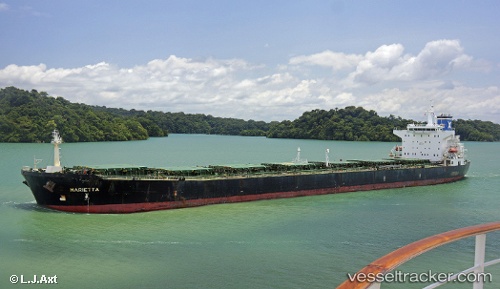
Vessel Marietta IMO: 9281437, MMSI: 248390000 Bulk Carrier
UTC, -3.90789, 115.77498, course: 309, speed: 0
UTC, -3.90789, 115.77498, course: 309, speed: 0
2026-02-18 17:27:13 UTC, -3.90789, 115.77498, course: 309, speed: 0
Live AIS position:
UTC. 13 nm SE of Bunati),
updated 2026-02-18 17:27:13 UTC.
Find the position of the vessel Marietta on the map. The latter are known coordinates and path.
marine traffic ship tracker show on live map
The current position of vessel Marietta is -3.90789 lat / 115.77498 lng. Updated: 2026-02-18 17:27:13 UTCCurrently sailing under the flag of Malta
Marietta built in 2004 year
Deadweight:
73880 tDetails:
Last coordinates of the vessel:
UTC, -3.90841, 115.77366, course: 359, speed: 0UTC, -3.90789, 115.77498, course: 309, speed: 0
UTC, -3.90789, 115.77498, course: 309, speed: 0
2026-02-18 17:27:13 UTC, -3.90789, 115.77498, course: 309, speed: 0