 vesseltracker.com
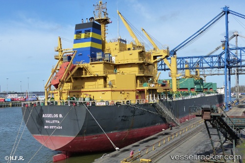
Vessel Aggelos B. IMO: 9577434, MMSI: 248828000 Bulk Carrier
UTC, 30.51833, 32.34500, course: -1, speed: 7
UTC, 30.71116, 32.35084, course: 343, speed: 10.3
2026-02-17 14:01:18 UTC, 31.10277, 32.30889, course: 12, speed: 10.5
Live AIS position:
UTC. Near Port Said East),
updated 2026-02-17 14:01:18 UTC.
Find the position of the vessel Aggelos B. on the map. The latter are known coordinates and path.
marine traffic ship tracker show on live map
The current position of vessel Aggelos B. is 31.10277 lat / 32.30889 lng. Updated: 2026-02-17 14:01:18 UTCDetails:
Last coordinates of the vessel:
UTC, 30.26135, 32.51022, course: 287, speed: 9.1UTC, 30.51833, 32.34500, course: -1, speed: 7
UTC, 30.71116, 32.35084, course: 343, speed: 10.3
2026-02-17 14:01:18 UTC, 31.10277, 32.30889, course: 12, speed: 10.5