 vesseltracker.com
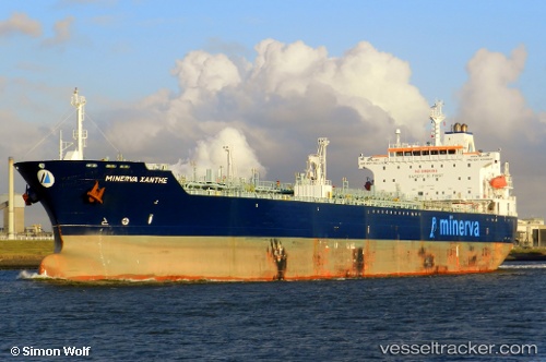
Vessel Minerva Xanthe IMO: 9318010, MMSI: 249115000 Crude Oil Tanker
UTC, 32.11878, -14.19801, course: 8, speed: 11.8
UTC, 32.53905, -14.09627, course: 10, speed: 10.8
2026-02-04 15:22:55 UTC, 32.83612, -14.01084, course: 10, speed: 11.5
Live AIS position:
UTC. 118 nm E of Porto Santo Island),
updated 2026-02-04 15:22:55 UTC.
Find the position of the vessel Minerva Xanthe on the map. The latter are known coordinates and path.
marine traffic ship tracker show on live map
The current position of vessel Minerva Xanthe is 32.83612 lat / -14.01084 lng. Updated: 2026-02-04 15:22:55 UTCCurrently sailing under the flag of Malta
Minerva Xanthe built in 2006 year
Deadweight:
50922 tDetails:
Last coordinates of the vessel:
UTC, 31.78569, -14.27834, course: 9, speed: 11.7UTC, 32.11878, -14.19801, course: 8, speed: 11.8
UTC, 32.53905, -14.09627, course: 10, speed: 10.8
2026-02-04 15:22:55 UTC, 32.83612, -14.01084, course: 10, speed: 11.5