 vesseltracker.com
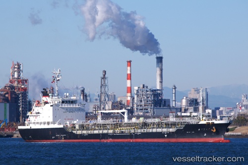
Vessel ALIKI IMO: 9520273, MMSI: 249243000 Oil/Chemical Tanker
UTC, 35.90903, 14.74635, course: 155, speed: 0
UTC, 35.90857, 14.74582, course: 139, speed: 0.1
2026-03-04 19:36:30 UTC, 35.87522, 14.79213, course: 153, speed: 0.3
Live Vessel ALIKI Analytics (details, animations, etc.)
Live AIS position: UTC. 11 nm E of Il-Kappara), updated 2026-03-04 19:36:30 UTC.Find the position of the vessel ALIKI on the map. The latter are known coordinates and path.
marine traffic ship tracker show on live map
The current position of vessel ALIKI is 35.87522 lat / 14.79213 lng. Updated: 2026-03-04 19:36:30 UTCCurrently sailing under the flag of Malta
Details:
Last coordinates of the vessel:
UTC, 35.87302, 14.77260, course: -1, speed: 0UTC, 35.90903, 14.74635, course: 155, speed: 0
UTC, 35.90857, 14.74582, course: 139, speed: 0.1
2026-03-04 19:36:30 UTC, 35.87522, 14.79213, course: 153, speed: 0.3