 vesseltracker.com
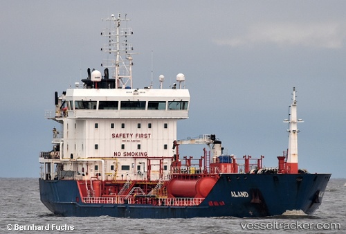
Vessel Mt Aland IMO: 9487380, MMSI: 249581000 Chemical Oil Products Tanker
UTC, 52.40959, 4.77344, course: 4, speed: 0
UTC, 52.40961, 4.77344, course: 4, speed: 0
2026-02-23 11:34:33 UTC, 52.40960, 4.77344, course: 4, speed: 0
Live AIS position:
UTC. Near NAUERNA),
updated 2026-02-23 11:34:33 UTC.
Find the position of the vessel Mt Aland on the map. The latter are known coordinates and path.
marine traffic ship tracker show on live map
The current position of vessel Mt Aland is 52.40960 lat / 4.77344 lng. Updated: 2026-02-23 11:34:33 UTCDetails:
Last coordinates of the vessel:
UTC, 52.40960, 4.77343, course: 4, speed: 0UTC, 52.40959, 4.77344, course: 4, speed: 0
UTC, 52.40961, 4.77344, course: 4, speed: 0
2026-02-23 11:34:33 UTC, 52.40960, 4.77344, course: 4, speed: 0