 vesseltracker.com
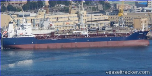
Vessel Greta K IMO: 9800374, MMSI: 249711000 Chemical Oil Products Tanker
UTC, 43.59468, -3.18428, course: 293, speed: 0.7
UTC, 43.59282, -3.20155, course: 270, speed: 1.9
2026-02-20 10:16:06 UTC, 43.59414, -3.24713, course: 292, speed: 0.8
Live AIS position:
UTC. 11 nm W of Getxo),
updated 2026-02-20 10:16:06 UTC.
Find the position of the vessel Greta K on the map. The latter are known coordinates and path.
marine traffic ship tracker show on live map
The current position of vessel Greta K is 43.59414 lat / -3.24713 lng. Updated: 2026-02-20 10:16:06 UTCCurrently sailing under the flag of Malta
Details:
Last coordinates of the vessel:
UTC, 43.58765, -3.15594, course: 296, speed: 0.4UTC, 43.59468, -3.18428, course: 293, speed: 0.7
UTC, 43.59282, -3.20155, course: 270, speed: 1.9
2026-02-20 10:16:06 UTC, 43.59414, -3.24713, course: 292, speed: 0.8