 vesseltracker.com
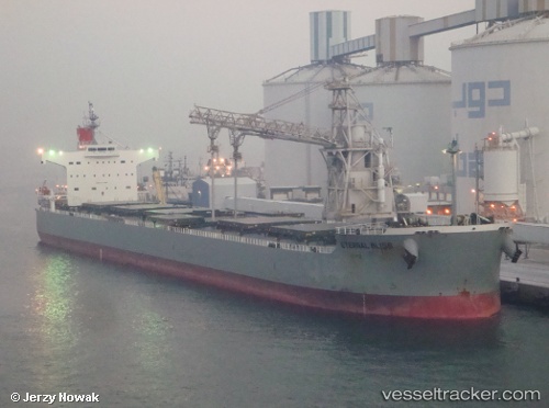
Vessel PELAGIA IMO: 9433626, MMSI: 249851000 Bulk Carrier
UTC, 23.17333, 60.73833, course: -1, speed: 0
UTC, 23.18167, 60.75833, course: -1, speed: 0
2026-02-27 17:37:58 UTC, 23.18500, 60.76667, course: -1, speed: 0
Live AIS position:
UTC. 77 nm NE of SUR),
updated 2026-02-27 17:37:58 UTC.
Find the position of the vessel PELAGIA on the map. The latter are known coordinates and path.
marine traffic ship tracker show on live map
The current position of vessel PELAGIA is 23.18500 lat / 60.76667 lng. Updated: 2026-02-27 17:37:58 UTCCurrently sailing under the flag of Malta
Details:
Last coordinates of the vessel:
UTC, 23.16024, 60.70962, course: -1, speed: 2.9UTC, 23.17333, 60.73833, course: -1, speed: 0
UTC, 23.18167, 60.75833, course: -1, speed: 0
2026-02-27 17:37:58 UTC, 23.18500, 60.76667, course: -1, speed: 0