 vesseltracker.com
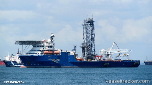
Vessel BOKA ATLANTIC IMO: 9545675, MMSI: 249979000 Dredging or underwater ops
UTC, 1.26892, 103.64349, course: 180, speed: 0
UTC, 1.26892, 103.64348, course: 180, speed: 0
2026-02-25 15:54:40 UTC, 1.26894, 103.64348, course: 180, speed: 0
Live AIS position:
UTC. Near Tuas),
updated 2026-02-25 15:54:40 UTC.
Find the position of the vessel BOKA ATLANTIC on the map. The latter are known coordinates and path.
marine traffic ship tracker show on live map
The current position of vessel BOKA ATLANTIC is 1.26894 lat / 103.64348 lng. Updated: 2026-02-25 15:54:40 UTCCurrently sailing under the flag of Malta
Details:
Last coordinates of the vessel:
UTC, 1.26896, 103.64349, course: 180, speed: 0UTC, 1.26892, 103.64349, course: 180, speed: 0
UTC, 1.26892, 103.64348, course: 180, speed: 0
2026-02-25 15:54:40 UTC, 1.26894, 103.64348, course: 180, speed: 0