 vesseltracker.com
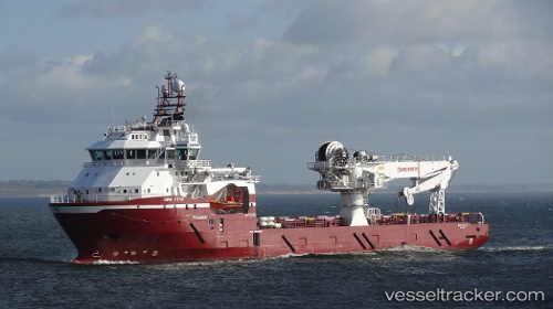
Vessel DINA STAR IMO: 9648697, MMSI: 255801980 Offshore Supply Ship
UTC, 60.50609, 2.04028, course: 260, speed: 0.5
UTC, 60.50609, 2.04028, course: 260, speed: 0.5
2026-03-19 04:22:25 UTC, 60.50609, 2.04028, course: 260, speed: 0.5
Live Vessel DINA STAR Analytics (details, animations, etc.)
Live AIS position: UTC. 19 nm W of Tune), updated 2026-03-19 04:22:25 UTC.Find the position of the vessel DINA STAR on the map. The latter are known coordinates and path.
marine traffic ship tracker show on live map
The current position of vessel DINA STAR is 60.50609 lat / 2.04028 lng. Updated: 2026-03-19 04:22:25 UTCCurrently sailing under the flag of Portugal
Details:
Last coordinates of the vessel:
UTC, 60.50630, 2.04135, course: 225, speed: 0.5UTC, 60.50609, 2.04028, course: 260, speed: 0.5
UTC, 60.50609, 2.04028, course: 260, speed: 0.5
2026-03-19 04:22:25 UTC, 60.50609, 2.04028, course: 260, speed: 0.5