 vesseltracker.com
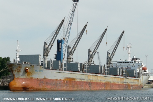
Vessel Selinda IMO: 9607459, MMSI: 255805360 Bulk Carrier
UTC, 10.51425, -68.00072, course: 71, speed: 0.1
UTC, 10.51403, -68.00058, course: 56, speed: 0.2
2026-02-05 07:26:37 UTC, 10.51390, -68.00040, course: 59, speed: 0.2
Live AIS position:
UTC. Near Puerto Cabello),
updated 2026-02-05 07:26:37 UTC.
Find the position of the vessel Selinda on the map. The latter are known coordinates and path.
marine traffic ship tracker show on live map
The current position of vessel Selinda is 10.51390 lat / -68.00040 lng. Updated: 2026-02-05 07:26:37 UTCDetails:
Last coordinates of the vessel:
UTC, 10.51402, -68.00053, course: 66, speed: 0.1UTC, 10.51425, -68.00072, course: 71, speed: 0.1
UTC, 10.51403, -68.00058, course: 56, speed: 0.2
2026-02-05 07:26:37 UTC, 10.51390, -68.00040, course: 59, speed: 0.2