 vesseltracker.com
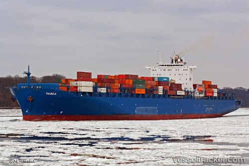
Vessel Tabea IMO: 9294812, MMSI: 255805778 Container Ship
UTC, 44.27920, 13.88403, course: 149, speed: 19.5
UTC, 43.53292, 14.62665, course: 143, speed: 19.4
2026-02-16 16:28:02 UTC, 43.53292, 14.62665, course: 143, speed: 19.4
Live AIS position:
UTC. 31 nm E of Kozina),
updated 2026-02-16 16:28:02 UTC.
Find the position of the vessel Tabea on the map. The latter are known coordinates and path.
marine traffic ship tracker show on live map
The current position of vessel Tabea is 43.53292 lat / 14.62665 lng. Updated: 2026-02-16 16:28:02 UTCCurrently sailing under the flag of Portugal
Tabea built in 2006 year
Deadweight:
68228 tDetails:
Last coordinates of the vessel:
UTC, 44.74807, 13.42975, course: 145, speed: 19.9UTC, 44.27920, 13.88403, course: 149, speed: 19.5
UTC, 43.53292, 14.62665, course: 143, speed: 19.4
2026-02-16 16:28:02 UTC, 43.53292, 14.62665, course: 143, speed: 19.4