 vesseltracker.com
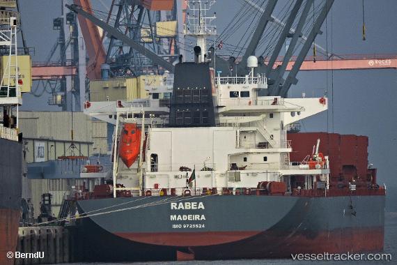
Vessel Rabea IMO: 9725524, MMSI: 255805858 Bulk Carrier
UTC, 55.03959, -1.37104, course: 81, speed: 0.1
UTC, 55.03999, -1.37112, course: 98, speed: 0.6
2026-01-29 14:26:11 UTC, 55.04028, -1.37158, course: 106, speed: 0.5
Live AIS position:
UTC. Near Tyne River),
updated 2026-01-29 14:26:11 UTC.
Find the position of the vessel Rabea on the map. The latter are known coordinates and path.
marine traffic ship tracker show on live map
The current position of vessel Rabea is 55.04028 lat / -1.37158 lng. Updated: 2026-01-29 14:26:11 UTCCurrently sailing under the flag of Portugal
Details:
Last coordinates of the vessel:
UTC, 55.03982, -1.37069, course: 103, speed: 0.3UTC, 55.03959, -1.37104, course: 81, speed: 0.1
UTC, 55.03999, -1.37112, course: 98, speed: 0.6
2026-01-29 14:26:11 UTC, 55.04028, -1.37158, course: 106, speed: 0.5