 vesseltracker.com
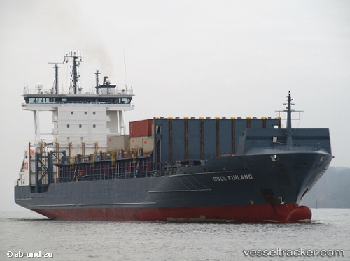
Vessel Anina IMO: 9354351, MMSI: 255805899 Container Ship
UTC, 59.67026, 24.06965, course: 72, speed: 7.7
UTC, 59.71090, 24.31591, course: 77, speed: 9.5
2026-02-08 17:47:17 UTC, 59.79195, 25.03930, course: 81, speed: 9
Live AIS position:
UTC. Near Kelnase),
updated 2026-02-08 17:47:17 UTC.
Find the position of the vessel Anina on the map. The latter are known coordinates and path.
marine traffic ship tracker show on live map
The current position of vessel Anina is 59.79195 lat / 25.03930 lng. Updated: 2026-02-08 17:47:17 UTCCurrently sailing under the flag of Portugal
Anina built in 2006 year
Deadweight:
13720 tDetails:
Last coordinates of the vessel:
UTC, 59.58331, 23.54385, course: 74, speed: 9.2UTC, 59.67026, 24.06965, course: 72, speed: 7.7
UTC, 59.71090, 24.31591, course: 77, speed: 9.5
2026-02-08 17:47:17 UTC, 59.79195, 25.03930, course: 81, speed: 9