 vesseltracker.com
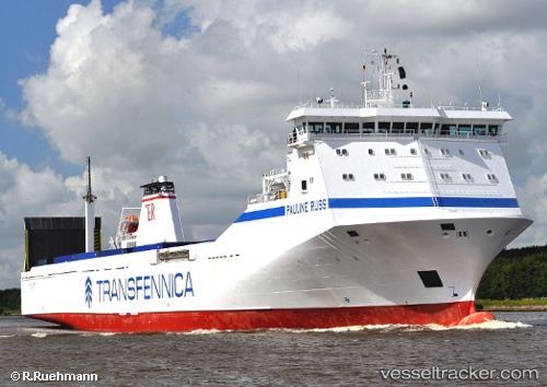
Vessel Pauline Russ IMO: 9198989, MMSI: 255805939 Ro Ro Cargo Ship
UTC, 37.18424, 6.81498, course: 330, speed: 17.7
UTC, 37.75044, 6.56593, course: 339, speed: 17.5
2026-02-05 02:26:26 UTC, 37.93400, 6.50682, course: 347, speed: 17.5
Live AIS position:
UTC. 37 nm N of Huévar),
updated 2026-02-05 02:26:26 UTC.
Find the position of the vessel Pauline Russ on the map. The latter are known coordinates and path.
marine traffic ship tracker show on live map
The current position of vessel Pauline Russ is 37.93400 lat / 6.50682 lng. Updated: 2026-02-05 02:26:26 UTCDetails:
Last coordinates of the vessel:
UTC, 36.88753, 6.90769, course: 14, speed: 0UTC, 37.18424, 6.81498, course: 330, speed: 17.7
UTC, 37.75044, 6.56593, course: 339, speed: 17.5
2026-02-05 02:26:26 UTC, 37.93400, 6.50682, course: 347, speed: 17.5