 vesseltracker.com
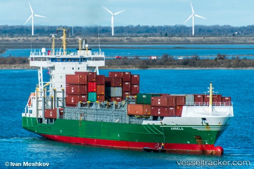
Vessel ELI A IMO: 9326976, MMSI: 255916037 Container Ship
UTC, 39.81205, -9.40940, course: -1, speed: 14.1
UTC, 39.29463, -9.85607, course: -1, speed: 14
2026-02-28 20:25:22 UTC, 38.64269, -10.09665, course: 166, speed: 13.6
Live AIS position:
UTC. 32 nm W of Colares),
updated 2026-02-28 20:25:22 UTC.
Find the position of the vessel ELI A on the map. The latter are known coordinates and path.
marine traffic ship tracker show on live map
The current position of vessel ELI A is 38.64269 lat / -10.09665 lng. Updated: 2026-02-28 20:25:22 UTCCurrently sailing under the flag of Portugal
Details:
Last coordinates of the vessel:
UTC, 40.08817, -9.17067, course: -1, speed: 14.1UTC, 39.81205, -9.40940, course: -1, speed: 14.1
UTC, 39.29463, -9.85607, course: -1, speed: 14
2026-02-28 20:25:22 UTC, 38.64269, -10.09665, course: 166, speed: 13.6