 vesseltracker.com
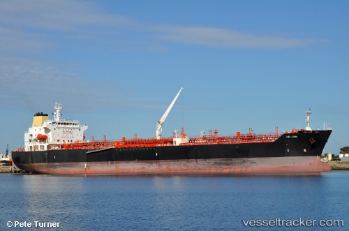
Vessel SAN REMO IMO: 9396725, MMSI: 255916103 Oil/Chemical Tanker
UTC, 23.33949, 59.51726, course: 304, speed: 12.6
UTC, 23.52678, 59.23013, course: 305, speed: 13
2026-02-27 23:45:33 UTC, 23.83299, 58.77086, course: 303, speed: 13.1
Live AIS position:
UTC. 15 nm NE of Port Sultan),
updated 2026-02-27 23:45:33 UTC.
Find the position of the vessel SAN REMO on the map. The latter are known coordinates and path.
marine traffic ship tracker show on live map
The current position of vessel SAN REMO is 23.83299 lat / 58.77086 lng. Updated: 2026-02-27 23:45:33 UTCCurrently sailing under the flag of Portugal
Details:
Last coordinates of the vessel:
UTC, 23.17397, 59.78689, course: 303, speed: 12.3UTC, 23.33949, 59.51726, course: 304, speed: 12.6
UTC, 23.52678, 59.23013, course: 305, speed: 13
2026-02-27 23:45:33 UTC, 23.83299, 58.77086, course: 303, speed: 13.1