 Santa Maria
Current Status
Where is the vessel?
Santa Maria is currently in Near Il-Kappara, based on AIS data received about 14h ago.
Latest AIS update:
Current position: 35.85548° N, 14.70272° E (Near Il-Kappara)
Average speed (last 7 days): Loading…
Average speed (last 30 days): Loading…
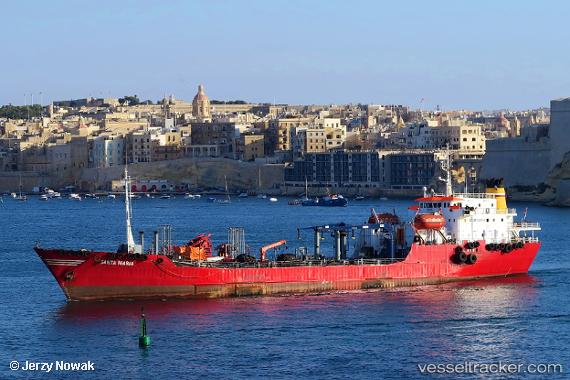
Vessel profile: Santa Maria is a Oil Products Tanker with dimensions 93m x 14m.
This page combines live AIS, route history, probable destination signals, nearby traffic, and port activity for practical vessel monitoring.
The current position of vessel Santa Maria is 35.85548 lat / 14.70272 lng. Updated: 2026-05-23 17:41:23 UTCNearest reference points:
- Near Xghajra
- 13 nm E of Il-Kappara
- Near Birgu (Vittoriosa)
Currently sailing under the flag of Malta ![]()
Santa Maria built in 1977 year
Deadweight:
4501 tDetails:
Live Vessel Santa Maria Analytics (details, animations, etc.)
Recent AIS points (UTC):
2026-05-23 14:20:23 UTC · 35.85492, 14.70289 · SOG 0 kn · COG 47°2026-05-23 15:56:23 UTC · 35.85502, 14.70292 · SOG 0 kn · COG 40°
2026-05-23 16:02:23 UTC · 35.85512, 14.70277 · SOG 0.1 kn · COG 51°
2026-05-23 17:41:23 UTC · 35.85548, 14.70272 · SOG 0.2 kn · COG 62°