 vesseltracker.com
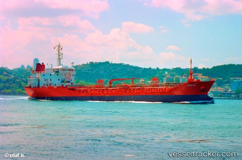
Vessel Marmara IMO: 9010230, MMSI: 256614000 Chemical Oil Products Tanker
UTC, 40.75296, 29.86187, course: -1, speed: 0
UTC, 40.75296, 29.86184, course: -1, speed: 0
2026-02-28 11:56:30 UTC, 40.75295, 29.86187, course: -1, speed: 0
Live AIS position:
UTC. Near Derince),
updated 2026-02-28 11:56:30 UTC.
Find the position of the vessel Marmara on the map. The latter are known coordinates and path.
marine traffic ship tracker show on live map
The current position of vessel Marmara is 40.75295 lat / 29.86187 lng. Updated: 2026-02-28 11:56:30 UTCCurrently sailing under the flag of Malta
Marmara built in 1996 year
Deadweight:
4994 tDetails:
Last coordinates of the vessel:
UTC, 40.75414, 29.86419, course: -1, speed: 0UTC, 40.75296, 29.86187, course: -1, speed: 0
UTC, 40.75296, 29.86184, course: -1, speed: 0
2026-02-28 11:56:30 UTC, 40.75295, 29.86187, course: -1, speed: 0