 vesseltracker.com
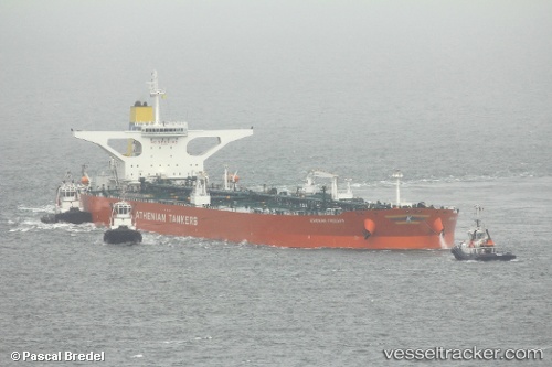
Vessel SEAKING IMO: 9602916, MMSI: 256727000 Crude Oil Tanker
UTC, 10.33234, 74.42185, course: 145, speed: 13.4
UTC, 10.02607, 74.62285, course: 145, speed: 13.1
2026-02-26 19:26:16 UTC, 10.02607, 74.62285, course: 145, speed: 13.1
Live AIS position:
UTC. 59 nm E of Kalpeni Island),
updated 2026-02-26 19:26:16 UTC.
Find the position of the vessel SEAKING on the map. The latter are known coordinates and path.
marine traffic ship tracker show on live map
The current position of vessel SEAKING is 10.02607 lat / 74.62285 lng. Updated: 2026-02-26 19:26:16 UTCCurrently sailing under the flag of Malta
Details:
Last coordinates of the vessel:
UTC, 10.33234, 74.42185, course: 145, speed: 13.4UTC, 10.33234, 74.42185, course: 145, speed: 13.4
UTC, 10.02607, 74.62285, course: 145, speed: 13.1
2026-02-26 19:26:16 UTC, 10.02607, 74.62285, course: 145, speed: 13.1