 vesseltracker.com
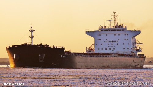
Vessel Raraka IMO: 9584504, MMSI: 256936000 Bulk Carrier
UTC, 45.63025, -122.69540, course: 126, speed: 0
UTC, 45.63026, -122.69539, course: 126, speed: 0
2026-02-06 10:33:34 UTC, 45.63018, -122.69539, course: 125, speed: 0.1
Live AIS position:
UTC. Near Vancouver),
updated 2026-02-06 10:33:34 UTC.
Find the position of the vessel Raraka on the map. The latter are known coordinates and path.
marine traffic ship tracker show on live map
The current position of vessel Raraka is 45.63018 lat / -122.69539 lng. Updated: 2026-02-06 10:33:34 UTCCurrently sailing under the flag of Malta
Raraka built in 2012 year
Deadweight:
76064 tDetails:
Last coordinates of the vessel:
UTC, 45.63025, -122.69540, course: 125, speed: 0UTC, 45.63025, -122.69540, course: 126, speed: 0
UTC, 45.63026, -122.69539, course: 126, speed: 0
2026-02-06 10:33:34 UTC, 45.63018, -122.69539, course: 125, speed: 0.1