 vesseltracker.com
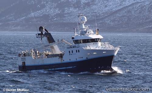
Vessel Doggi IMO: 9233117, MMSI: 257247000 Fishing Vessel
UTC, 63.02705, 6.28368, course: 40, speed: 10.4
UTC, 63.15266, 6.62845, course: 132, speed: 4.1
2026-01-30 08:12:31 UTC, 63.15684, 6.65579, course: 275, speed: 3.7
Live AIS position:
UTC. 18 nm NW of Harøysundet),
updated 2026-01-30 08:12:31 UTC.
Find the position of the vessel Doggi on the map. The latter are known coordinates and path.
marine traffic ship tracker show on live map
The current position of vessel Doggi is 63.15684 lat / 6.65579 lng. Updated: 2026-01-30 08:12:31 UTCCurrently sailing under the flag of Norway
Details:
Last coordinates of the vessel:
UTC, 62.74227, 5.72539, course: 87, speed: 4.2UTC, 63.02705, 6.28368, course: 40, speed: 10.4
UTC, 63.15266, 6.62845, course: 132, speed: 4.1
2026-01-30 08:12:31 UTC, 63.15684, 6.65579, course: 275, speed: 3.7