 vesseltracker.com
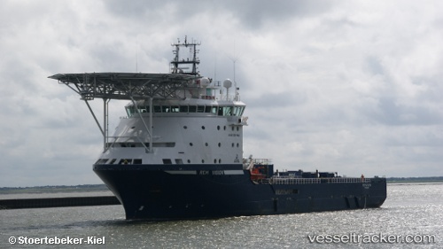
Vessel Normand Tonjer IMO: 9422108, MMSI: 257551000 Offshore Tug Supply Ship
UTC, 13.91369, -24.06806, course: 142, speed: 10.5
UTC, 13.58600, -23.81817, course: 138, speed: 12.5
2026-03-06 14:16:06 UTC, 13.19859, -23.49340, course: 136, speed: 13.1
Live Vessel Normand Tonjer Analytics (details, animations, etc.)
Live AIS position: UTC. 102 nm S of Praia), updated 2026-03-06 14:16:06 UTC.Find the position of the vessel Normand Tonjer on the map. The latter are known coordinates and path.
marine traffic ship tracker show on live map
The current position of vessel Normand Tonjer is 13.19859 lat / -23.49340 lng. Updated: 2026-03-06 14:16:06 UTCCurrently sailing under the flag of Norway
Normand Tonjer built in 2010 year
Deadweight:
5260 tDetails:
Last coordinates of the vessel:
UTC, 14.15317, -24.25917, course: 139, speed: 9.6UTC, 13.91369, -24.06806, course: 142, speed: 10.5
UTC, 13.58600, -23.81817, course: 138, speed: 12.5
2026-03-06 14:16:06 UTC, 13.19859, -23.49340, course: 136, speed: 13.1