 vesseltracker.com
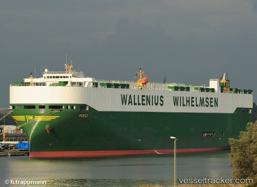
Vessel PORGY IMO: 9409338, MMSI: 257732000 Vehicles Carrier
UTC, 48.82762, -123.43765, course: 243, speed: 0
UTC, 48.82769, -123.43781, course: 176, speed: 0
2026-02-25 16:03:26 UTC, 48.82789, -123.43843, course: 169, speed: 0
Live AIS position:
UTC. Near GANGES),
updated 2026-02-25 16:03:26 UTC.
Find the position of the vessel PORGY on the map. The latter are known coordinates and path.
marine traffic ship tracker show on live map
The current position of vessel PORGY is 48.82789 lat / -123.43843 lng. Updated: 2026-02-25 16:03:26 UTCCurrently sailing under the flag of Norway
Details:
Last coordinates of the vessel:
UTC, 48.82728, -123.43752, course: 280, speed: 0UTC, 48.82762, -123.43765, course: 243, speed: 0
UTC, 48.82769, -123.43781, course: 176, speed: 0
2026-02-25 16:03:26 UTC, 48.82789, -123.43843, course: 169, speed: 0