 vesseltracker.com
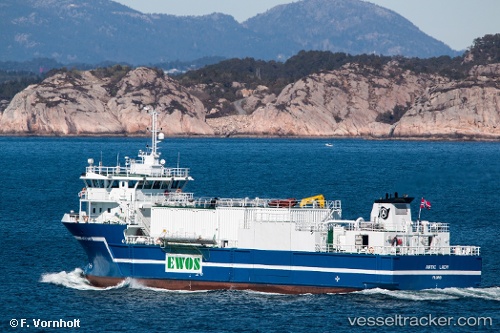
Vessel Aqua Lady IMO: 9369813, MMSI: 258270000 Multi Purpose Carrier
UTC, 66.74483, 13.49962, course: 3, speed: 0
UTC, 66.74483, 13.49960, course: 4, speed: 0
2026-02-08 08:14:08 UTC, 66.74483, 13.49961, course: 4, speed: 0
Live AIS position:
UTC. Near Forøy),
updated 2026-02-08 08:14:08 UTC.
Find the position of the vessel Aqua Lady on the map. The latter are known coordinates and path.
marine traffic ship tracker show on live map
The current position of vessel Aqua Lady is 66.74483 lat / 13.49961 lng. Updated: 2026-02-08 08:14:08 UTCCurrently sailing under the flag of Norway
Aqua Lady built in 2006 year
Deadweight:
1350 tDetails:
Last coordinates of the vessel:
UTC, 66.74484, 13.49953, course: 4, speed: 0UTC, 66.74483, 13.49962, course: 3, speed: 0
UTC, 66.74483, 13.49960, course: 4, speed: 0
2026-02-08 08:14:08 UTC, 66.74483, 13.49961, course: 4, speed: 0