 vesseltracker.com
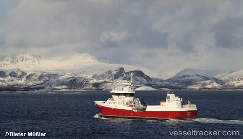
Vessel Novatrans IMO: 9579652, MMSI: 259085000 Fish Carrier
UTC, 65.87726, -23.48606, course: 153, speed: 0
UTC, 65.92418, -23.72826, course: 303, speed: 0.6
2026-02-15 12:17:44 UTC, 66.04833, -23.83500, course: -1, speed: 7
Live AIS position:
UTC. Near FLATEYRI),
updated 2026-02-15 12:17:44 UTC.
Find the position of the vessel Novatrans on the map. The latter are known coordinates and path.
marine traffic ship tracker show on live map
The current position of vessel Novatrans is 66.04833 lat / -23.83500 lng. Updated: 2026-02-15 12:17:44 UTCCurrently sailing under the flag of Norway
Novatrans built in 2011 year
Deadweight:
1400 tDetails:
Last coordinates of the vessel:
UTC, 65.87727, -23.48608, course: 153, speed: 0UTC, 65.87726, -23.48606, course: 153, speed: 0
UTC, 65.92418, -23.72826, course: 303, speed: 0.6
2026-02-15 12:17:44 UTC, 66.04833, -23.83500, course: -1, speed: 7