 vesseltracker.com
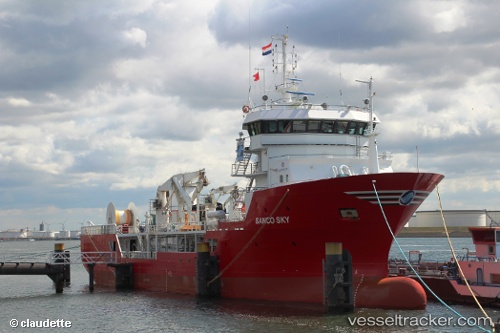
Vessel OCEAN SKY IMO: 9349033, MMSI: 259294000 Research/Survey Vessel
UTC, 6.36296, 3.38841, course: 222, speed: 0.1
UTC, 6.36304, 3.38830, course: 231, speed: 0.1
2026-02-27 05:22:15 UTC, 6.36167, 3.38667, course: -1, speed: 0
Live AIS position:
UTC. Near Apapa),
updated 2026-02-27 05:22:15 UTC.
Find the position of the vessel OCEAN SKY on the map. The latter are known coordinates and path.
marine traffic ship tracker show on live map
The current position of vessel OCEAN SKY is 6.36167 lat / 3.38667 lng. Updated: 2026-02-27 05:22:15 UTCCurrently sailing under the flag of Norway
Details:
Last coordinates of the vessel:
UTC, 6.36301, 3.38838, course: 218, speed: 0.3UTC, 6.36296, 3.38841, course: 222, speed: 0.1
UTC, 6.36304, 3.38830, course: 231, speed: 0.1
2026-02-27 05:22:15 UTC, 6.36167, 3.38667, course: -1, speed: 0