 vesseltracker.com
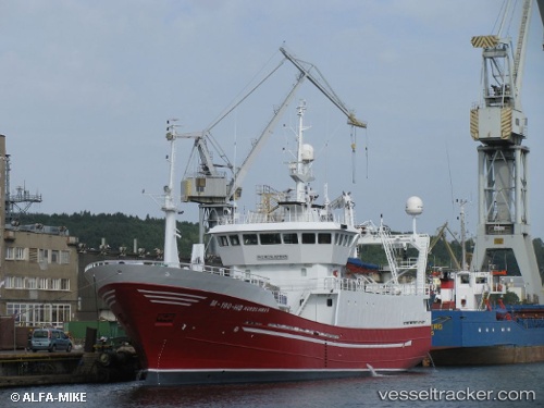
Vessel Andrea L IMO: 9113422, MMSI: 259324000 Fish Carrier
UTC, 68.23433, 14.57788, course: 48, speed: 0
UTC, 68.23433, 14.57787, course: 47, speed: 0
2026-02-25 10:01:15 UTC, 68.23432, 14.57788, course: 49, speed: 0
Live AIS position:
UTC. Near SVOLVAER),
updated 2026-02-25 10:01:15 UTC.
Find the position of the vessel Andrea L on the map. The latter are known coordinates and path.
marine traffic ship tracker show on live map
The current position of vessel Andrea L is 68.23432 lat / 14.57788 lng. Updated: 2026-02-25 10:01:15 UTCCurrently sailing under the flag of Norway
Andrea L built in 1996 year
Deadweight:
400 tDetails:
Last coordinates of the vessel:
UTC, 68.23430, 14.57785, course: 48, speed: 0UTC, 68.23433, 14.57788, course: 48, speed: 0
UTC, 68.23433, 14.57787, course: 47, speed: 0
2026-02-25 10:01:15 UTC, 68.23432, 14.57788, course: 49, speed: 0