 vesseltracker.com
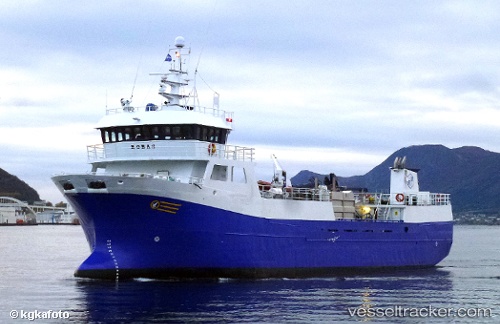
Vessel Robas IMO: 9165487, MMSI: 259488000 Fish Carrier
UTC, 60.25501, 5.13875, course: 153, speed: 8.4
UTC, 60.03812, 5.11584, course: 229, speed: 0
2026-02-25 19:40:53 UTC, 60.03816, 5.11589, course: 228, speed: 0
Live AIS position:
UTC. Near Salthella),
updated 2026-02-25 19:40:53 UTC.
Find the position of the vessel Robas on the map. The latter are known coordinates and path.
marine traffic ship tracker show on live map
The current position of vessel Robas is 60.03816 lat / 5.11589 lng. Updated: 2026-02-25 19:40:53 UTCDetails:
Last coordinates of the vessel:
UTC, 60.26823, 5.10806, course: 248, speed: 0.1UTC, 60.25501, 5.13875, course: 153, speed: 8.4
UTC, 60.03812, 5.11584, course: 229, speed: 0
2026-02-25 19:40:53 UTC, 60.03816, 5.11589, course: 228, speed: 0