 vesseltracker.com
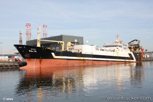
Vessel ALINA IMO: 8918318, MMSI: 261001225 Fishing Vessel
UTC, 48.91989, -6.19764, course: 69, speed: 11.8
UTC, 49.07333, -5.73500, course: -1, speed: 11
2026-02-11 00:12:11 UTC, 49.22667, -5.03500, course: -1, speed: 11
Live AIS position:
UTC. 34 nm W of Verzy),
updated 2026-02-11 00:12:11 UTC.
Find the position of the vessel ALINA on the map. The latter are known coordinates and path.
marine traffic ship tracker show on live map
The current position of vessel ALINA is 49.22667 lat / -5.03500 lng. Updated: 2026-02-11 00:12:11 UTCCurrently sailing under the flag of Poland
ALINA built in 1990 year
Deadweight:
4475 tDetails:
Last coordinates of the vessel:
UTC, 48.77833, -6.67500, course: -1, speed: 11UTC, 48.91989, -6.19764, course: 69, speed: 11.8
UTC, 49.07333, -5.73500, course: -1, speed: 11
2026-02-11 00:12:11 UTC, 49.22667, -5.03500, course: -1, speed: 11