 vesseltracker.com
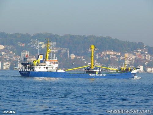
Vessel Kalenakliyat 2 IMO: 7901825, MMSI: 271002023 General Cargo Ship
UTC, 38.86381, 26.97351, course: -1, speed: 0.2
UTC, 38.86381, 26.97355, course: -1, speed: 0
2026-03-24 05:50:36 UTC, 38.86384, 26.97342, course: -1, speed: 0.2
Live Vessel Kalenakliyat 2 Analytics (details, animations, etc.)
Live AIS position: UTC. Near Aliaga), updated 2026-03-24 05:50:36 UTC.Find the position of the vessel Kalenakliyat 2 on the map. The latter are known coordinates and path.
marine traffic ship tracker show on live map
The current position of vessel Kalenakliyat 2 is 38.86384 lat / 26.97342 lng. Updated: 2026-03-24 05:50:36 UTCCurrently sailing under the flag of Turkey
Kalenakliyat 2 built in 1980 year
Deadweight:
1092 tDetails:
Last coordinates of the vessel:
UTC, 38.86393, 26.97329, course: -1, speed: 0.3UTC, 38.86381, 26.97351, course: -1, speed: 0.2
UTC, 38.86381, 26.97355, course: -1, speed: 0
2026-03-24 05:50:36 UTC, 38.86384, 26.97342, course: -1, speed: 0.2