 vesseltracker.com
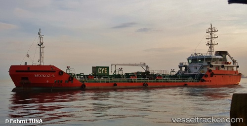
Vessel Beykoz e IMO: 9733856, MMSI: 271043927 Oil Products Tanker
UTC, 40.77036, 29.67523, course: -1, speed: 0
UTC, 40.77056, 29.67537, course: -1, speed: 0.1
2026-02-17 00:09:11 UTC, 40.77033, 29.67685, course: -1, speed: 0.3
Live AIS position:
UTC. Near Evyap Port /Kocaeli),
updated 2026-02-17 00:09:11 UTC.
Find the position of the vessel Beykoz e on the map. The latter are known coordinates and path.
marine traffic ship tracker show on live map
The current position of vessel Beykoz e is 40.77033 lat / 29.67685 lng. Updated: 2026-02-17 00:09:11 UTCCurrently sailing under the flag of Turkey
Details:
Last coordinates of the vessel:
UTC, 40.77021, 29.67677, course: -1, speed: 0.1UTC, 40.77036, 29.67523, course: -1, speed: 0
UTC, 40.77056, 29.67537, course: -1, speed: 0.1
2026-02-17 00:09:11 UTC, 40.77033, 29.67685, course: -1, speed: 0.3