 vesseltracker.com
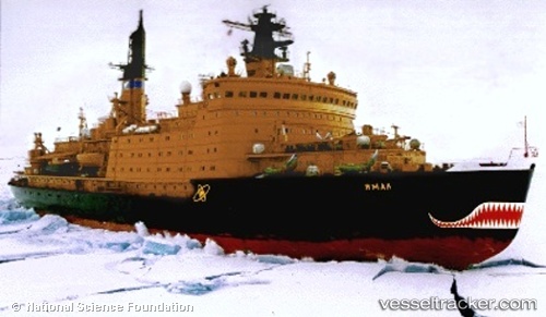
Vessel YAMAL IMO: 9077549, MMSI: 273132400 Nuclear Icebreaker
UTC, 76.98880, 71.31424, course: 274, speed: 1.2
UTC, 77.03026, 71.40145, course: 280, speed: 1.2
2026-01-31 13:34:22 UTC, 77.06669, 71.47130, course: 285, speed: 1.1
Live AIS position:
UTC. 254 nm NW of Dikson),
updated 2026-01-31 13:34:22 UTC.
Find the position of the vessel YAMAL on the map. The latter are known coordinates and path.
marine traffic ship tracker show on live map
The current position of vessel YAMAL is 77.06669 lat / 71.47130 lng. Updated: 2026-01-31 13:34:22 UTCCurrently sailing under the flag of Russia
YAMAL built in 1992 year
Deadweight:
2750 tDetails:
Last coordinates of the vessel:
UTC, 76.95462, 71.24430, course: 272, speed: 1.2UTC, 76.98880, 71.31424, course: 274, speed: 1.2
UTC, 77.03026, 71.40145, course: 280, speed: 1.2
2026-01-31 13:34:22 UTC, 77.06669, 71.47130, course: 285, speed: 1.1