 vesseltracker.com
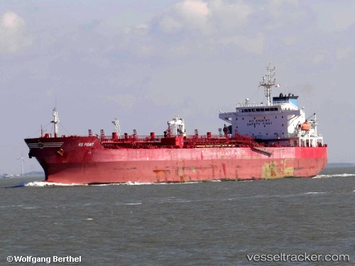
Vessel PROXIMA IMO: 9329655, MMSI: 273264690 Chemical Oil Products Tanker
UTC, 59.76535, 24.79694, course: 75, speed: 9.9
UTC, 59.83965, 25.48804, course: 80, speed: 8.8
2026-02-14 17:32:51 UTC, 59.86812, 25.80250, course: 70, speed: 6.7
Live AIS position:
UTC. 13 nm N of Viinistu Sadam),
updated 2026-02-14 17:32:51 UTC.
Find the position of the vessel PROXIMA on the map. The latter are known coordinates and path.
marine traffic ship tracker show on live map
The current position of vessel PROXIMA is 59.86812 lat / 25.80250 lng. Updated: 2026-02-14 17:32:51 UTCCurrently sailing under the flag of Russia
PROXIMA built in 2008 year
Deadweight:
40149 tDetails:
Last coordinates of the vessel:
UTC, 59.71732, 24.39075, course: 76, speed: 10UTC, 59.76535, 24.79694, course: 75, speed: 9.9
UTC, 59.83965, 25.48804, course: 80, speed: 8.8
2026-02-14 17:32:51 UTC, 59.86812, 25.80250, course: 70, speed: 6.7