 vesseltracker.com
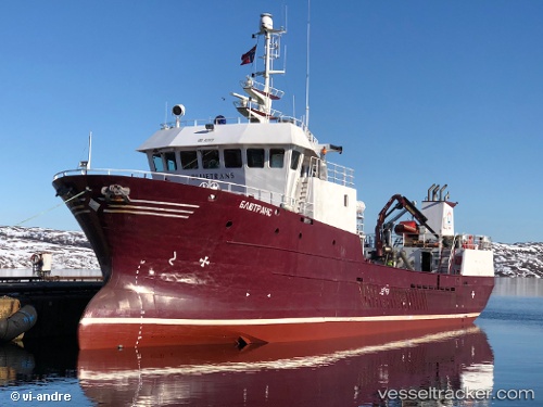
Vessel Bluetrans IMO: 9220835, MMSI: 273382220 Fish Carrier
UTC, 68.94509, 33.00835, course: 245, speed: 0
UTC, 68.94515, 33.00809, course: 245, speed: 0
2026-01-22 16:29:53 UTC, 69.13262, 32.20218, course: 245, speed: 5
Live AIS position:
UTC. 16 nm SW of Ura-Guba),
updated 2026-01-22 16:29:53 UTC.
Find the position of the vessel Bluetrans on the map. The latter are known coordinates and path.
marine traffic ship tracker show on live map
The current position of vessel Bluetrans is 69.13262 lat / 32.20218 lng. Updated: 2026-01-22 16:29:53 UTCCurrently sailing under the flag of Russia
Bluetrans built in 2000 year
Deadweight:
300 tDetails:
Last coordinates of the vessel:
UTC, 69.11427, 33.04596, course: 245, speed: 52.6UTC, 68.94509, 33.00835, course: 245, speed: 0
UTC, 68.94515, 33.00809, course: 245, speed: 0
2026-01-22 16:29:53 UTC, 69.13262, 32.20218, course: 245, speed: 5