 vesseltracker.com
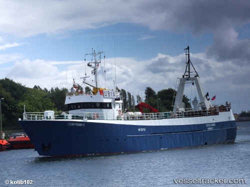
Vessel Severyanin Ii IMO: 7311824, MMSI: 273448120
UTC, 71.13524, 22.76734, course: 286, speed: 4
UTC, 71.01933, 22.40505, course: 233, speed: 4.9
2026-03-01 13:43:17 UTC, 71.09182, 22.52590, course: 18, speed: 4.3
Live AIS position:
UTC. 26 nm NW of Akkarfjord),
updated 2026-03-01 13:43:17 UTC.
Find the position of the vessel Severyanin Ii on the map. The latter are known coordinates and path.
marine traffic ship tracker show on live map
The current position of vessel Severyanin Ii is 71.09182 lat / 22.52590 lng. Updated: 2026-03-01 13:43:17 UTCCurrently sailing under the flag of Russia
Severyanin Ii built in 1973 year
Deadweight:
328 tDetails:
Last coordinates of the vessel:
UTC, 71.10479, 22.56161, course: 42, speed: 3.5UTC, 71.13524, 22.76734, course: 286, speed: 4
UTC, 71.01933, 22.40505, course: 233, speed: 4.9
2026-03-01 13:43:17 UTC, 71.09182, 22.52590, course: 18, speed: 4.3