 vesseltracker.com
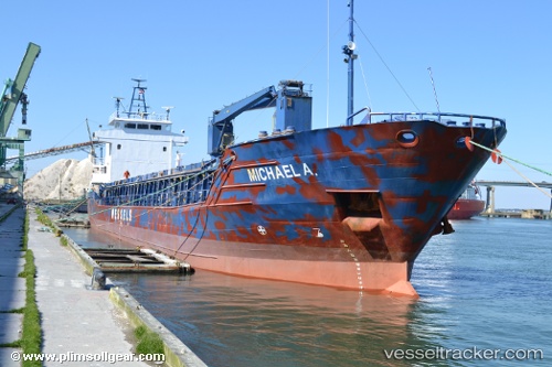
Vessel Michael A. IMO: 9056076, MMSI: 304010858 Multi Purpose Carrier
UTC, 14.01101, -60.99434, course: 192, speed: 0
UTC, 14.01102, -60.99436, course: 191, speed: 0
2026-02-03 19:42:35 UTC, 13.98093, -61.33428, course: 257, speed: 10.1
Live AIS position:
UTC. 18 nm W of CUL DESAC),
updated 2026-02-03 19:42:35 UTC.
Find the position of the vessel Michael A. on the map. The latter are known coordinates and path.
marine traffic ship tracker show on live map
The current position of vessel Michael A. is 13.98093 lat / -61.33428 lng. Updated: 2026-02-03 19:42:35 UTCDetails:
Last coordinates of the vessel:
UTC, 14.01099, -60.99432, course: 191, speed: 0UTC, 14.01101, -60.99434, course: 192, speed: 0
UTC, 14.01102, -60.99436, course: 191, speed: 0
2026-02-03 19:42:35 UTC, 13.98093, -61.33428, course: 257, speed: 10.1