 vesseltracker.com
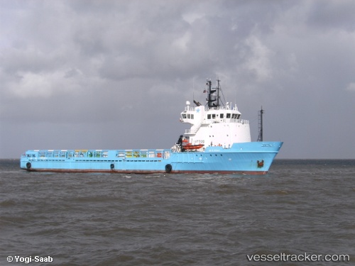
Vessel OCEAN CONNECTOR IMO: 8912340, MMSI: 304347000 Offshore Supply Ship
UTC, 38.62500, 24.12333, course: -1, speed: 0
UTC, 38.62500, 24.12333, course: -1, speed: 0
2026-02-28 16:11:34 UTC, 38.62500, 24.12333, course: -1, speed: 0
Live AIS position:
UTC. Near KYMI),
updated 2026-02-28 16:11:34 UTC.
Find the position of the vessel OCEAN CONNECTOR on the map. The latter are known coordinates and path.
marine traffic ship tracker show on live map
The current position of vessel OCEAN CONNECTOR is 38.62500 lat / 24.12333 lng. Updated: 2026-02-28 16:11:34 UTCCurrently sailing under the flag of Antigua and Barbuda
Details:
Last coordinates of the vessel:
UTC, 38.58333, 24.14167, course: -1, speed: 3UTC, 38.62500, 24.12333, course: -1, speed: 0
UTC, 38.62500, 24.12333, course: -1, speed: 0
2026-02-28 16:11:34 UTC, 38.62500, 24.12333, course: -1, speed: 0