 vesseltracker.com
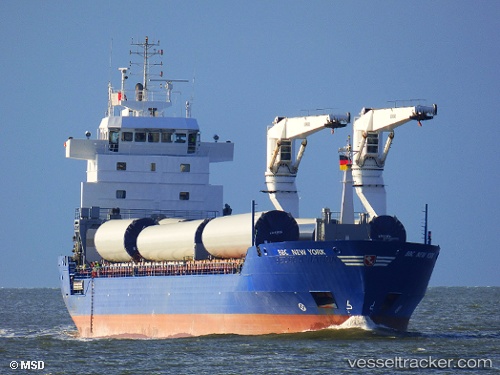
Vessel UNISUN IMO: 9448451, MMSI: 305046000 General Cargo Ship
UTC, -34.08269, 25.75710, course: 220, speed: 10.2
UTC, -34.18664, 25.37988, course: 250, speed: 11.3
2026-01-30 06:05:25 UTC, -34.31886, 24.88805, course: 257, speed: 11.5
Live AIS position:
UTC. Near ST FRANCIS),
updated 2026-01-30 06:05:25 UTC.
Find the position of the vessel UNISUN on the map. The latter are known coordinates and path.
marine traffic ship tracker show on live map
The current position of vessel UNISUN is -34.31886 lat / 24.88805 lng. Updated: 2026-01-30 06:05:25 UTCCurrently sailing under the flag of Antigua and Barbuda
UNISUN built in 2009 year
Deadweight:
9851 tDetails:
Last coordinates of the vessel:
UTC, -33.81379, 25.69153, course: 188, speed: 6.2UTC, -34.08269, 25.75710, course: 220, speed: 10.2
UTC, -34.18664, 25.37988, course: 250, speed: 11.3
2026-01-30 06:05:25 UTC, -34.31886, 24.88805, course: 257, speed: 11.5