 vesseltracker.com
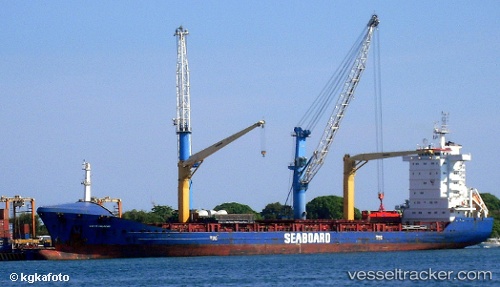
Vessel MAREN IMO: 9245677, MMSI: 305208000 Container Ship
UTC, 54.60410, -1.15604, course: 136, speed: 0
UTC, 54.60413, -1.15601, course: 136, speed: 0
2026-02-01 05:23:59 UTC, 54.60415, -1.15604, course: 137, speed: 0
Live AIS position:
UTC. Near TEES),
updated 2026-02-01 05:23:59 UTC.
Find the position of the vessel MAREN on the map. The latter are known coordinates and path.
marine traffic ship tracker show on live map
The current position of vessel MAREN is 54.60415 lat / -1.15604 lng. Updated: 2026-02-01 05:23:59 UTCCurrently sailing under the flag of Antigua and Barbuda
MAREN built in 2002 year
Deadweight:
13698 tDetails:
Last coordinates of the vessel:
UTC, 54.60413, -1.15601, course: 136, speed: 0UTC, 54.60410, -1.15604, course: 136, speed: 0
UTC, 54.60413, -1.15601, course: 136, speed: 0
2026-02-01 05:23:59 UTC, 54.60415, -1.15604, course: 137, speed: 0