 vesseltracker.com
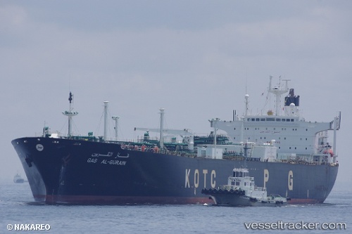
Vessel GONG DE TIAN IMO: 9005065, MMSI: 307086000 Lpg Tanker
UTC, 1.70331, 104.70352, course: 330, speed: 0
UTC, 1.70309, 104.70326, course: 337, speed: 0
2026-02-26 09:39:47 UTC, 1.70310, 104.70332, course: -1, speed: 0
Live AIS position:
UTC. 39 nm NE of PENGERANG),
updated 2026-02-26 09:39:47 UTC.
Find the position of the vessel GONG DE TIAN on the map. The latter are known coordinates and path.
marine traffic ship tracker show on live map
The current position of vessel GONG DE TIAN is 1.70310 lat / 104.70332 lng. Updated: 2026-02-26 09:39:47 UTCCurrently sailing under the flag of Aruba
Details:
Last coordinates of the vessel:
UTC, 1.70482, 104.70443, course: 289, speed: 0UTC, 1.70331, 104.70352, course: 330, speed: 0
UTC, 1.70309, 104.70326, course: 337, speed: 0
2026-02-26 09:39:47 UTC, 1.70310, 104.70332, course: -1, speed: 0