 vesseltracker.com
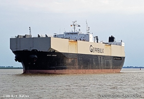
Vessel Mozu Arrow IMO: 8918227, MMSI: 309372000 Multi Purpose Carrier
UTC, 37.14988, 132.13531, course: 33, speed: 12.2
UTC, 37.93833, 133.09666, course: -1, speed: 12
2026-02-01 19:38:51 UTC, 38.41167, 133.67500, course: -1, speed: 12
Live AIS position:
UTC. 112 nm NE of Dokdo),
updated 2026-02-01 19:38:51 UTC.
Find the position of the vessel Mozu Arrow on the map. The latter are known coordinates and path.
marine traffic ship tracker show on live map
The current position of vessel Mozu Arrow is 38.41167 lat / 133.67500 lng. Updated: 2026-02-01 19:38:51 UTCCurrently sailing under the flag of Bahamas
Mozu Arrow built in 1992 year
Deadweight:
42276 tDetails:
Last coordinates of the vessel:
UTC, 37.14988, 132.13531, course: 33, speed: 12.2UTC, 37.14988, 132.13531, course: 33, speed: 12.2
UTC, 37.93833, 133.09666, course: -1, speed: 12
2026-02-01 19:38:51 UTC, 38.41167, 133.67500, course: -1, speed: 12