 vesseltracker.com
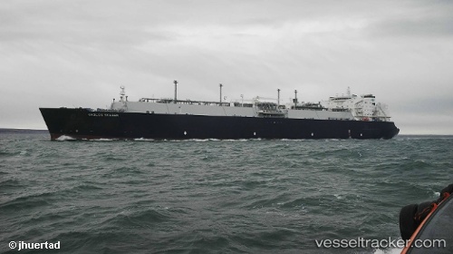
Vessel Gaslog Skagen IMO: 9626285, MMSI: 310664000 Lng Tanker
UTC, 3.80667, 110.22833, course: -1, speed: 10
UTC, 3.87833, 110.52167, course: -1, speed: 11
2026-02-03 13:30:57 UTC, 3.95667, 110.87167, course: -1, speed: 10
Live AIS position:
UTC. 87 nm N of Pulau Bruit),
updated 2026-02-03 13:30:57 UTC.
Find the position of the vessel Gaslog Skagen on the map. The latter are known coordinates and path.
marine traffic ship tracker show on live map
The current position of vessel Gaslog Skagen is 3.95667 lat / 110.87167 lng. Updated: 2026-02-03 13:30:57 UTCDetails:
Last coordinates of the vessel:
UTC, 3.73944, 109.91935, course: 78, speed: 11.8UTC, 3.80667, 110.22833, course: -1, speed: 10
UTC, 3.87833, 110.52167, course: -1, speed: 11
2026-02-03 13:30:57 UTC, 3.95667, 110.87167, course: -1, speed: 10