 vesseltracker.com
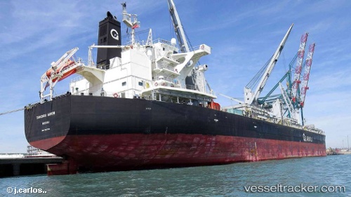
Vessel Tanchou Arrow IMO: 9567740, MMSI: 311000193 Bulk Carrier
UTC, -34.06580, -59.03393, course: 329, speed: 0
UTC, -34.06580, -59.03383, course: 329, speed: 0
2026-01-26 18:24:13 UTC, -34.06580, -59.03388, course: 329, speed: 0
Live AIS position:
UTC. Near Zarate),
updated 2026-01-26 18:24:13 UTC.
Find the position of the vessel Tanchou Arrow on the map. The latter are known coordinates and path.
marine traffic ship tracker show on live map
The current position of vessel Tanchou Arrow is -34.06580 lat / -59.03388 lng. Updated: 2026-01-26 18:24:13 UTCDetails:
Last coordinates of the vessel:
UTC, -34.06580, -59.03390, course: 329, speed: 0UTC, -34.06580, -59.03393, course: 329, speed: 0
UTC, -34.06580, -59.03383, course: 329, speed: 0
2026-01-26 18:24:13 UTC, -34.06580, -59.03388, course: 329, speed: 0