 vesseltracker.com
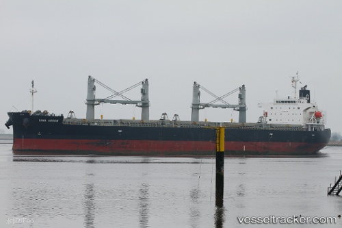
Vessel Tawa Arrow IMO: 9401879, MMSI: 311000825 General Cargo Ship
UTC, 44.90207, -1.55382, course: 4, speed: 9.4
UTC, 45.20304, -1.62246, course: 348, speed: 9.6
2026-02-20 10:15:37 UTC, 45.65669, -1.68968, course: 356, speed: 11.3
Live AIS position:
UTC. 23 nm W of La Palmyre),
updated 2026-02-20 10:15:37 UTC.
Find the position of the vessel Tawa Arrow on the map. The latter are known coordinates and path.
marine traffic ship tracker show on live map
The current position of vessel Tawa Arrow is 45.65669 lat / -1.68968 lng. Updated: 2026-02-20 10:15:37 UTCDetails:
Last coordinates of the vessel:
UTC, 44.57883, -1.51523, course: 342, speed: 8.4UTC, 44.90207, -1.55382, course: 4, speed: 9.4
UTC, 45.20304, -1.62246, course: 348, speed: 9.6
2026-02-20 10:15:37 UTC, 45.65669, -1.68968, course: 356, speed: 11.3