 vesseltracker.com
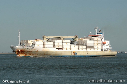
Vessel STAR PRIMA IMO: 9338747, MMSI: 311000958 Refrigerated Cargo Ship
UTC, 34.66667, -42.40667, course: -1, speed: 18
UTC, 35.00333, -41.80500, course: -1, speed: 17
2026-02-26 20:07:37 UTC, 35.38667, -41.07667, course: -1, speed: 17
Live AIS position:
UTC. 89 nm SW of Eureka Springs),
updated 2026-02-26 20:07:37 UTC.
Find the position of the vessel STAR PRIMA on the map. The latter are known coordinates and path.
marine traffic ship tracker show on live map
The current position of vessel STAR PRIMA is 35.38667 lat / -41.07667 lng. Updated: 2026-02-26 20:07:37 UTCCurrently sailing under the flag of Bahamas
STAR PRIMA built in 2006 year
Deadweight:
13189 tDetails:
Last coordinates of the vessel:
UTC, 34.32081, -43.03379, course: 53, speed: 19.3UTC, 34.66667, -42.40667, course: -1, speed: 18
UTC, 35.00333, -41.80500, course: -1, speed: 17
2026-02-26 20:07:37 UTC, 35.38667, -41.07667, course: -1, speed: 17