 vesseltracker.com
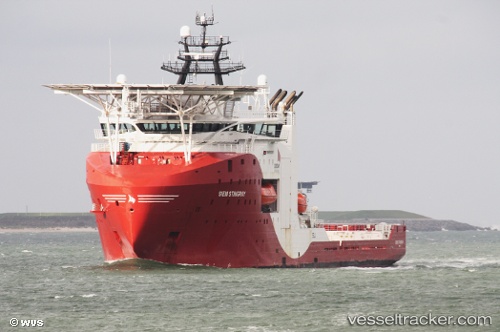
Vessel SIEM STINGRAY IMO: 9676292, MMSI: 311001327 Other Type
UTC, 63.50305, 5.40291, course: 199, speed: 0.6
UTC, 63.50751, 5.40227, course: 204, speed: 1
2026-02-25 07:45:11 UTC, 63.50884, 5.40723, course: 203, speed: 0.7
Live AIS position:
UTC. 52 nm NW of Steinshamn),
updated 2026-02-25 07:45:11 UTC.
Find the position of the vessel SIEM STINGRAY on the map. The latter are known coordinates and path.
marine traffic ship tracker show on live map
The current position of vessel SIEM STINGRAY is 63.50884 lat / 5.40723 lng. Updated: 2026-02-25 07:45:11 UTCCurrently sailing under the flag of Bahamas
Details:
Last coordinates of the vessel:
UTC, 63.49783, 5.40817, course: 193, speed: 0.4UTC, 63.50305, 5.40291, course: 199, speed: 0.6
UTC, 63.50751, 5.40227, course: 204, speed: 1
2026-02-25 07:45:11 UTC, 63.50884, 5.40723, course: 203, speed: 0.7