 vesseltracker.com
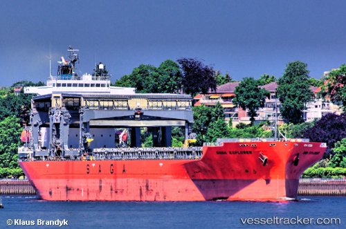
Vessel SAGA EXPLORER IMO: 9343493, MMSI: 311001607 General Cargo
UTC, 0.27947, -44.73826, course: 324, speed: 12.3
UTC, 0.49366, -44.92485, course: 322, speed: 12.7
2026-02-23 06:17:18 UTC, 0.93728, -45.30202, course: 330, speed: 12.1
Live AIS position:
UTC. 148 nm NE of Braganca),
updated 2026-02-23 06:17:18 UTC.
Find the position of the vessel SAGA EXPLORER on the map. The latter are known coordinates and path.
marine traffic ship tracker show on live map
The current position of vessel SAGA EXPLORER is 0.93728 lat / -45.30202 lng. Updated: 2026-02-23 06:17:18 UTCCurrently sailing under the flag of Bahamas
Details:
Last coordinates of the vessel:
UTC, -0.08067, -44.44896, course: 324, speed: 11.9UTC, 0.27947, -44.73826, course: 324, speed: 12.3
UTC, 0.49366, -44.92485, course: 322, speed: 12.7
2026-02-23 06:17:18 UTC, 0.93728, -45.30202, course: 330, speed: 12.1