 vesseltracker.com
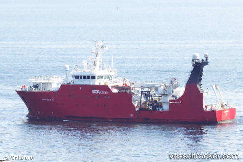
Vessel OCEAN GEOGRAPH IMO: 9267388, MMSI: 311001838 Research/Survey Vessel
UTC, 52.57985, 1.74073, course: 273, speed: 0
UTC, 52.57983, 1.74073, course: 273, speed: 0
2026-02-26 00:05:08 UTC, 52.57980, 1.74072, course: -1, speed: 0
Live AIS position:
UTC. Near GREAT YARMOUTH),
updated 2026-02-26 00:05:08 UTC.
Find the position of the vessel OCEAN GEOGRAPH on the map. The latter are known coordinates and path.
marine traffic ship tracker show on live map
The current position of vessel OCEAN GEOGRAPH is 52.57980 lat / 1.74072 lng. Updated: 2026-02-26 00:05:08 UTCCurrently sailing under the flag of Bahamas
Details:
Last coordinates of the vessel:
UTC, 52.57982, 1.74072, course: -1, speed: 0UTC, 52.57985, 1.74073, course: 273, speed: 0
UTC, 52.57983, 1.74073, course: 273, speed: 0
2026-02-26 00:05:08 UTC, 52.57980, 1.74072, course: -1, speed: 0