 vesseltracker.com
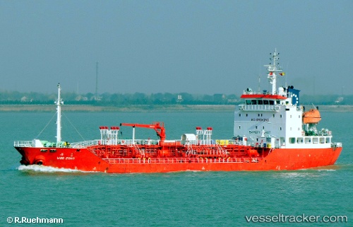
Vessel HARMONY APOLLO IMO: 9297280, MMSI: 311001848 Oil/Chemical Tanker
UTC, 9.38132, 106.65373, course: 226, speed: 11
UTC, 9.36345, 106.63833, course: 223, speed: 11
2026-02-27 20:34:26 UTC, 9.36345, 106.63833, course: 223, speed: 11
Live AIS position:
UTC. 38 nm S of Cai Cui Port),
updated 2026-02-27 20:34:26 UTC.
Find the position of the vessel HARMONY APOLLO on the map. The latter are known coordinates and path.
marine traffic ship tracker show on live map
The current position of vessel HARMONY APOLLO is 9.36345 lat / 106.63833 lng. Updated: 2026-02-27 20:34:26 UTCCurrently sailing under the flag of Bahamas
Details:
Last coordinates of the vessel:
UTC, 9.80217, 106.95831, course: 202, speed: 11UTC, 9.38132, 106.65373, course: 226, speed: 11
UTC, 9.36345, 106.63833, course: 223, speed: 11
2026-02-27 20:34:26 UTC, 9.36345, 106.63833, course: 223, speed: 11